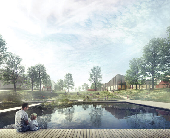


The plan comprises 3 suggestions for the new sports park, all proposing a re-use of the construction residue earth as hills/small ridges, to give rhythm and shelter to the different spaces of the park. The formation of the earth banks divide the park construction into phases, making it possible to begin the park already with the surrounding housing blocks, where the residue earth can be placed on to the planned site. This enables one park space to be built at a time.
The challenging climate conditions on Jätkäsaari – a cape extruding in the Gulf of Finland – give a guideline and a starting point for the planning of the area. The varying spatial design, diverse topography and well-placed plantings create places with shelter for recreation and socializing. Furthermore, the design approach enables different types of game fields and places for sports and active movement.


Version 1
Functional Structure
The large fields and parking areas are situated on the eastern side, the smaller to the West.
2 parking lots.
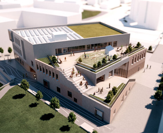
One larger building volume integrated in the spectators’ stand.
Spatial Structure
Large terrain forms, long ridges.
Freely growing trees on the edges of the park. A row of trees following the ridges.
Open surfaces form long valley-like spaces in between the ridges, joining together the different sizes of fields and planes.
Traffic Plan
A light traffic route runs along the edges, connecting the larger and smaller fields and activities together.
Parking is divided into two areas.
A running paths follows the ridges, giving a choice of running routes.
Maintenance driving is enabled through light traffic routes or parking spaces.
Version 2
Functional Structure
Larger game fields and parking areas are situated in the corners of the park, leaving room for an open, flexible and versatile gamefield/plane in the middle.
1 parking lot
One larger, pavilion-type building volume connecting to the northern game field and parking lot.
Spatial Structure
Islet-like hills/banks.
Trees are planted mainly on the edges.
Open surfaces follow each other in a chain.
Traffic Plan
Light traffic route forms a spine through the sports park, functioning as a link between the different fields that vary in size and landscapes.
A circular running route follows the hills’ ridges. Parking is centralized in the northeast corner.
As in version 1, maintenance is enabled through light traffic routes or the parking area.
Version 3
Functional Structure
The large fields and parking areas are situated on the eastern side, the smaller to the West.
1 parking lot
2 larger building volumes in connection to the spectators’ stands.
Spatial Structure
Large terrain forms. Hills/ridges on the edges.
The main pathway is aligned by trees.
Like version 2, the park spaces are in chainlike form.
Traffic Plan
Throughway for light traffic follows the edges, defined by the large playing fields and winter sport centre, traversing the park in the centre.
Three circles form running routes, which follow the hills’ ridges.
Parking and maintenance are organized similarly to version 2.


